Every print. One map.
Gas, electric, telecom and water for all of Alberta, in the locate colours you already know. Office, truck or tablet, it opens in a browser in seconds.
7 days free. No card needed.
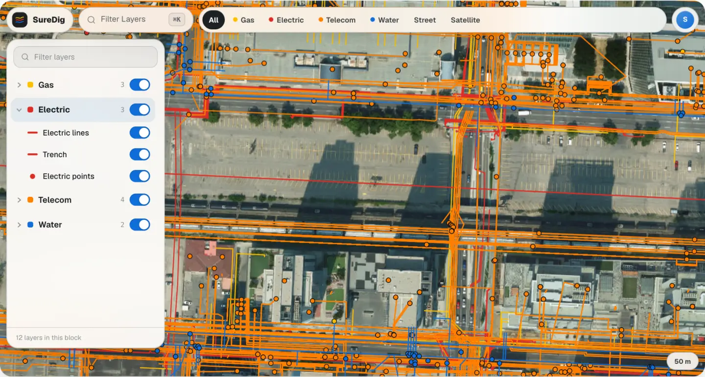
Gas, electric, telecom and water for all of Alberta, in the locate colours you already know. Office, truck or tablet, it opens in a browser in seconds.
7 days free. No card needed.
A locate on a normal day means half a dozen company viewers, each with its own login, quirks, and loading spinners. SureDig collapses all of it into one map that opens in seconds.
Click any line and identify it: owner, layer, every field the print carries. Measure offsets, drop to GPS, light or dark for the cab. No GIS training required.
IDENTIFY
Gas
Gas lines
37 million mapped features across 355 layers, province-wide. Each source is re-pulled every 30 days and drawn in the APWA colours you already paint with.
Records are reproduced from operator and public sources as published. SureDig is not affiliated with or endorsed by these operators.
ATCO Gas in the city. AER-licensed pipelines across the province, abandoned and orphaned lines included.
ENMAX, FortisAlberta and EQUS, down to structures, conduit and street lights.
Telus, Rogers and Bell: cable, fibre and conduit.
City of Calgary water, rural water co-ops and irrigation districts.
The AltaLIS township grid. Search any legal land description, or any of 3 million Alberta addresses, rural included.
Step 1 of 5
An email, a password, and the terms. Verify your email and the map is yours for 7 days. No GIS login, no six vendor portals.
What you’ll do
Create the account, click the link in your inbox, add your company name. About a minute.
Step 2 of 5
Same map on your phone. Layers, search, identify. The field view, not a cut-down app.
What you’ll see
The live map, sized for a phone. Everything you opened on a laptop is here.
Step 3 of 5
The tablet you already carry. Full SureDig: layers, search, identify, in a browser tab at the dig.
What you’ll see
Any tablet with a browser and a data connection. No app store, no GIS install.
Step 4 of 5
The laptop you already carry. Full SureDig: layers, search, identify, in a browser tab in the cab.
What you’ll see
Any laptop with a browser and a data connection. No app store, no GIS install.
Step 5 of 5
When the trial ends, subscribe from the map: $200 CAD a month per license, billed yearly. Not for you? Do nothing. There is no card on file to charge.
Equipping a crew?
Email [email protected] and we’ll set up licenses for the whole team.
Per license. Try it on real tickets for a week first. No card, no setup call.
Annual subscription
$200
CAD / month per license, billed yearly ($2,400)
Start 7-day free trialNo credit card. Subscribe only if you keep it.
One license per locator, plus one for whoever reviews tickets. We’ll set up the whole team with you.
The honest answers, including what SureDig is not.
Something else? Email [email protected].